

Geography:
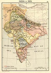
The Sikh Empire spanned a total of over 200,000 sq mi (520,000 km2) at its zenith.
The Punjab was a region straddling India and the Afghan Durrani Empire. The following modern-day political divisions made up the historical Sikh Empire:
Punjab region, to Mithankot in the south
Punjab, Pakistan, excluding Bahawalpur State
Punjab, India, south to areas just across the Sutlej river
Haryana, India
Himachal Pradesh, India, south to areas just across the Sutlej river
Jammu Division, Jammu and Kashmir, India and Pakistan (1808–1846)
Kashmir, from 5 July 1819 to 15 March 1846, India/Pakistan/China
Kashmir Valley, India from 1819 to 1846
Gilgit, Gilgit–Baltistan, Pakistan, from 1842 to 1846[citation needed]
Ladakh, India 1834–1846
Khyber Pass, Afghanistan/Pakistan
Peshawar, Pakistan (taken in 1818, retaken in 1834)
Khyber Pakhtunkhwa and the Federally Administered Tribal Areas, Pakistan (documented from Hazara (taken in 1818, again in 1836) to Bannu).
Parts of Western Tibet, China (briefly in 1841, to Taklakot),
Jamrud District (Khyber Agency, Pakistan) was the westernmost limit of the Sikh Empire. The westward expansion was stopped in the Battle of Jamrud, in which the Afghans managed to kill the prominent Sikh general Hari Singh Nalwa in an offensive, though the Sikhs successfully held their position at their Jamrud fort. Ranjit Singh sent his General Sirdar Bahadur Gulab Singh Powind thereafter as reinforcement and he crushed the Pashtun rebellion harshly.In 1838, Ranjit Singh with his troops marched into Kabul to take part in the victory parade along with the British after restoring Shah Shoja to the Afghan throne at Kabul.
Geography:
The Sikh Empire spanned a total of over 200,000 sq mi (520,000 km2) at its zenith.
The Punjab was a region straddling India and the Afghan Durrani Empire. The following modern-day political divisions made up the historical Sikh Empire:
Punjab region, to Mithankot in the south
Punjab, Pakistan, excluding Bahawalpur State
Punjab, India, south to areas just across the Sutlej river
Haryana, India
Himachal Pradesh, India, south to areas just across the Sutlej river
Jammu Division, Jammu and Kashmir, India and Pakistan (1808–1846)
Kashmir, from 5 July 1819 to 15 March 1846, India/Pakistan/China
Kashmir Valley, India from 1819 to 1846
Gilgit, Gilgit–Baltistan, Pakistan, from 1842 to 1846[citation needed]
Ladakh, India 1834–1846
Khyber Pass, Afghanistan/Pakistan
Peshawar, Pakistan (taken in 1818, retaken in 1834)
Khyber Pakhtunkhwa and the Federally Administered Tribal Areas, Pakistan (documented from Hazara (taken in 1818, again in 1836) to Bannu).
Parts of Western Tibet, China (briefly in 1841, to Taklakot),
Jamrud District (Khyber Agency, Pakistan) was the westernmost limit of the Sikh Empire. The westward expansion was stopped in the Battle of Jamrud, in which the Afghans managed to kill the prominent Sikh general Hari Singh Nalwa in an offensive, though the Sikhs successfully held their position at their Jamrud fort. Ranjit Singh sent his General Sirdar Bahadur Gulab Singh Powind thereafter as reinforcement and he crushed the Pashtun rebellion harshly.In 1838, Ranjit Singh with his troops marched into Kabul to take part in the victory parade along with the British after restoring Shah Shoja to the Afghan throne at Kabul.
0 Comments
0 Shares
0 Reviews
